
The road from Akureyri crests one last rise, and the lake opens up below: flat, grey-blue and dotted with green humps that look as if a giant thumb pressed the land again and again. A campervan Iceland road trip suits this corner of the north well, since the sights sit close together and a van parked near the shore lets the first crater walk start straight after breakfast. Mývatn is a shallow lake in an area of active volcanism. Within a short drive you’ll find tephra rings, explosion pits, lava that cooled within living memory and hillsides that hiss.
The seven stops below are ranked by how much they give back for the effort, with a note on how each formed and how to walk it without harming yourself or the ground.
1. Is Hverfjall worth the climb?
Yes, and it’s the one to prioritise if time is tight. Hverfjall, also called Hverfell, is a nearly symmetrical tephra crater that formed about 2500 years ago, when rising magma hit groundwater and the blast threw out huge amounts of ash and rock fragments. That debris settled into a ring. The ring is still remarkably even: 463 m high and 1040 m across.
The path up is steep and made of loose, dark gravel that slides underfoot, so proper shoes matter more than fitness. At the rim, the walk around it shows the lake on one side and raw lava country on the other. Expect fierce wind, even when the car park is calm.
Don’t head down into the bottom, since access isn’t permitted and the loose slopes erode so quickly that every footprint stays for years.
2. What are the pseudocraters at Skútustaðir?
They look like small volcanoes. Nothing erupted from beneath them. Skútustaðagígar, on the south shore, formed when lava flowed over wetlands, and water trapped under the hot rock flashed to steam and burst up through the lava, leaving clusters of rounded cones with hollow centres.
A group of them at Skútustaðir is protected as a natural monument, and the hour-long walk along the pseudocraters gives a wide view of Mývatn and the mountains around it. Stay on the marked paths, since the grassy slopes tear easily.
In early summer the midges can be thick here, and a head net weighs nothing yet makes the difference between a pleasant stroll and a quick retreat.
3. Can you swim in Víti at Krafla?
No, and nobody should try. Víti is a large explosion crater about 500 m from the Krafla site, and it holds a crater lake formed during the Mývatnseldar eruptions of 1724 to 1729. The water often shows a milky green-blue. It photographs well from the rim. A path follows the edge, and it turns slick and sticky after rain, so keep well back from the drop, which is steeper than it looks from the car park.
4. What did the Krafla Fires leave behind?
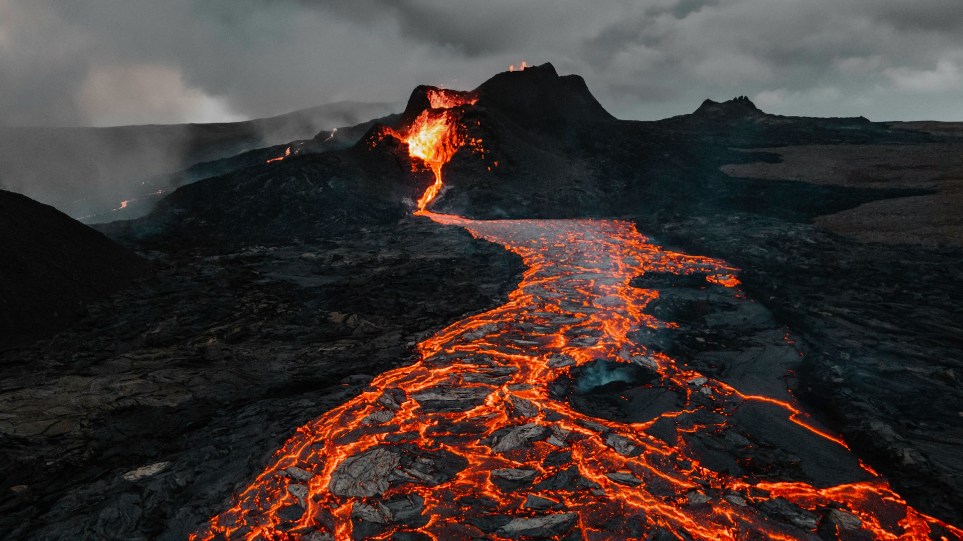
The Krafla Fires were a run of eruptions between 1975 and 1984, and the lava fields they produced are young enough that the ground still feels unfinished. Black, jagged crust spreads across the area, cracks breathe out steam, and in places the rock is warm to the touch.
Marked trails lead through it, and those markers exist for a reason. The surface can be thin over hollow spaces or hot ground, so walking off the route is a real risk, not just a matter of manners. Allow more time than the distance suggests. The rough footing slows everyone down, and there’s plenty to stop and look at.
5. How hard is the hike up Vindbelgjarfjall?
Short but steep, on the western side of the lake. The trail climbs hard from the start, and the top half is loose scree where poles help. The payoff is the clearest overview of the whole area: pseudocraters scattered across the water, Hverfjall’s ring to the east and the lava fields beyond. It’s the place to understand how all the other stops fit together. It also sees far fewer people than the famous sights.
6. How was Dimmuborgir formed?
Dimmuborgir isn’t a crater, but it belongs on any list of the area’s volcanic oddities. A lake of molten lava pooled here over wet ground, and steam rising from below cooled the lava into hollow pillars and arches. When the pool drained away, those towers stayed standing. The result is a maze of dark formations and small caves, with several marked loops of different lengths. Children manage it easily, and it’s a good choice when rain or wind makes the crater rims unpleasant.
7. Why does Námaskarð smell of sulphur?
Because the ground is cooking. Námaskarð sits on the pass east of the lake, where geothermal heat pushes gas and steam up through vents and boiling mud pots. Sulphur and other minerals stain the slopes in yellows, oranges and rust reds, and the smell of rotten eggs hits the moment the car door opens.
Stay behind the ropes. The crust around the mud pots can be thin, with scalding mud just below, and people have been badly burned stepping where it looked solid. Expect the clay to cling to your shoes as well, so keep an old pair for this stop.
What should you do first?
Start by checking the wind forecast the evening before. Calm mornings are the time for Hverfjall and Vindbelgjarfjall, where gusts on exposed rims can make walking miserable.
Then group the eastern sights. Námaskarð, Víti and the Krafla lava fields sit along the same road, so they fit neatly into one half-day, with Dimmuborgir on the way back toward the lake.
Save the Skútustaðir pseudocraters for late in the day, when the light lies low over the water and the hour-long loop makes a gentle finish after the steeper climbs.