
A road trip through Ireland, England and Scotland requires at least one ferry crossing over the Irish Sea. Established routes connect Holyhead with Dublin and Cairnryan with Belfast, allowing road trippers to continue their journey without changing vehicles. From London, the M1 or M40 leads towards the Midlands, where the M6 provides onwards connections to northern England and Scotland. Drivers heading for the ferry port at Holyhead continue across North Wales on the A55.
Covering several regions requires realistic driving times, advance ferry reservations and a clear route between overnight stops. This itinerary highlights five routes across the three countries, with details on road connections, notable landmarks and useful stopping points for Londoners planning a longer drive beyond the capital.
Dublin, Ireland: Day Trips to the Cliffs of Moher
Dublin and the Cliffs of Moher sit on opposite sides of Ireland. Drivers leaving the capital take the M4 and M6 west towards Galway before joining the M18 and N85 through County Clare. The Cliffs of Moher stretch for eight kilometres along the edge of the Burren region. They rise almost vertically from the Atlantic, reaching their highest point of 214 metres near O’Brien’s Tower, a stone observation tower constructed in 1835.
Rural Irish routes can include single-track lanes, slow-moving farm machinery and limited lighting after dark. For anyone planning day tours from Dublin, a dedicated coach removes the need to drive across the country and return to the capital on the same day. The northern section of the coastal walk connects the visitor centre with Doolin, although walkers should check current access information before setting out. Doolin Pier operates passenger ferries to the Aran Islands during the sailing season, subject to sea conditions. The cliffs also support thousands of nesting seabirds, including Atlantic puffins, razorbills and guillemots during the spring and early summer breeding season.
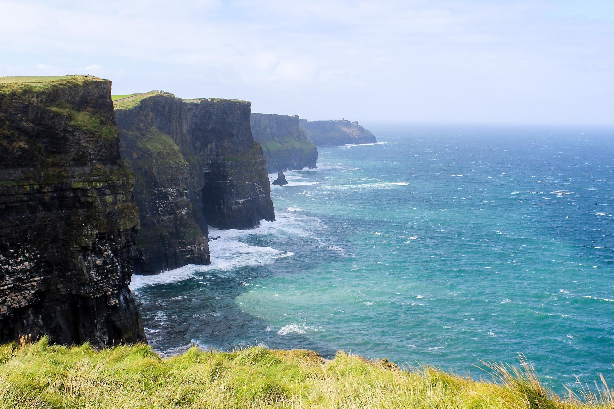
Image by Ieva Karklina from Pixabay
Why Edinburgh Castle Sits on an Extinct Volcano
Edinburgh Castle stands on Castle Rock, a volcanic plug dating back approximately 350 million years to the Carboniferous Period. Glacial erosion wore away the softer surrounding sedimentary rock during the last Ice Age, leaving cliff faces up to 80 metres high on three sides. The summit rises around 130 metres above sea level, giving the fortress a strong defensive position overlooking the Firth of Forth. The Royal Mile extends eastwards from the castle gates along the tail of the glacial crag.
Inside the castle complex, the Crown Room displays the Honours of Scotland, the oldest Crown Jewels in Britain. Nearby, Mons Meg is a six-tonne siege cannon made in 1449 that could fire a 150-kilogram stone gunstone over three kilometres. Drivers approaching Edinburgh can use the A1 or A720 bypass. Parking is restricted within much of the Old Town, so visitors can use a central multi-storey car park before walking up Castlehill. Current parking and traffic restrictions should be checked before arrival.
England’s Lake District, Home to Its Highest Peak
The Lake District National Park in Cumbria contains Scafell Pike, England’s highest mountain, which reaches 978 metres above sea level. The shortest route begins near Wasdale Head on the western side of the national park, although other approaches start from Eskdale, Langdale and Borrowdale. Motorists can enter the region from several junctions along the M6, with Junction 36 serving the southern lakes and Junction 40 providing access from the north. The A591 links Kendal, Windermere, Ambleside and Keswick, while mountain roads such as Kirkstone Pass connect valleys through narrow sections and steep gradients.
Windermere is England’s largest natural lake, covering 14.8 square kilometres and reaching a maximum depth of approximately 64 metres. Public passenger launches connect Bowness-on-Windermere, Ambleside and Lakeside, although timetables should be checked before travelling. Farther north, Keswick stands near Derwentwater and provides access to Skiddaw, which rises to 931 metres. Long-stay parking is available around Keswick, but walkers should confirm current restrictions and availability before leaving their vehicles for the day.
The Cotswolds: England’s Largest Protected Landscape
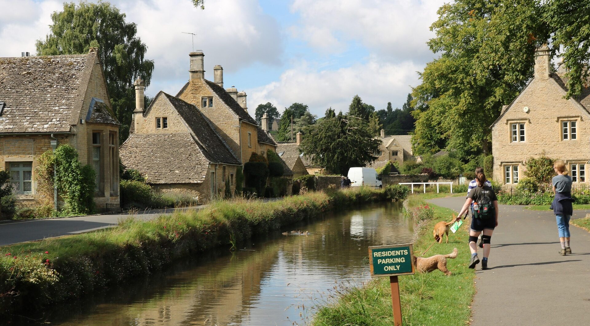
Covering 2,038 square kilometres across six counties, the Cotswolds is the largest designated National Landscape in England. It spans parts of Gloucestershire, Oxfordshire, Wiltshire, Somerset, Worcestershire and Warwickshire. From London, motorists can reach the southern Cotswolds via the M4 or approach the northern area using the M40 and A40. The A429, known as the Fosse Way, is a principal north-south route through the region and follows the line of an ancient Roman road.
In Bibury, Arlington Row contains stone buildings constructed in 1380 as a monastic wool store. They were converted into weavers’ cottages during the 17th century and remain a preserved example of local oolitic limestone architecture. Near Broadway, Broadway Tower stands on Beacon Hill at 312 metres above sea level. The 20-metre-high folly, designed by James Wyatt in 1798, provides views across the Severn Valley towards the Welsh mountains on clear days. Cirencester contains archaeological evidence from the Roman settlement of Corinium Dobunnorum, while the Corinium Museum displays mosaics and other objects excavated in and around the town.
The North Coast 500 Loops Scotland’s Rugged Highlands
The North Coast 500 is a 516-mile route around the northern Highlands, with Inverness serving as its conventional start and finish. It passes through the historic counties of Inverness-shire, Ross and Cromarty, Sutherland and Caithness. Travelling anticlockwise, motorists leave Inverness on the A9, cross the Kessock Bridge and join the A835 towards Ullapool. Much of the western section uses single-track roads with designated passing places, which drivers should keep clear for approaching vehicles.
On the Applecross peninsula, Bealach na Bà climbs to 626 metres above sea level through gradients of up to 20 per cent and several hairpin bends. Farther north, Dunnet Head in Caithness forms the northernmost point of mainland Britain. Its lighthouse stands above cliffs approximately 90 metres high, with views across the Pentland Firth towards Orkney in clear conditions. Fuel stations become less frequent across the northern stretches, so motorists should fill up in larger settlements and check current opening hours. Some rural pumps are unmanned and may not accept every payment card.
Ready to hit the road?
A road trip across Ireland, England and Scotland covers several types of terrain, from Edinburgh’s volcanic Castle Rock and the Lake District’s glacial landscape to the limestone Burren and the mountain passes of the Scottish Highlands. Each stage also requires different planning, including booking an Irish Sea ferry, finding parking outside historic city centres and locating fuel stops along rural Highland roads.
Linking these regional routes carefully avoids unnecessary backtracking and keeps daily driving distances manageable. Leaving spare time between major stops also allows for poor weather, traffic or ferry delays. Before departing London, motorists should confirm ferry reservations, check current road conditions and identify suitable car parks near each overnight stop. These preparations create a practical route through all three countries without turning the holiday into a rigid driving schedule.